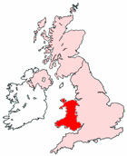
Map of Carmarthen Wales and Surrounding Areas
Detailed street map of Carmarthen town centre and the surrounding areas, towns & villages.
View Larger Map |
||
 |
||
Carmarthen Map Wales Showing the Town and its Surroundings
Street Map of the Welsh Town of Carmarthen: Find places of interest in the town of Carmarthen in Dyfed, Wales UK, with this handy printable street map. View streets in the centre of Carmarthen and areas which surround Carmarthen, including neighbouring villages and attractions. Large Carmarthen map.
Places of interest in and surrounding Carmarthen, Dyfed include: Scott's Wood, University of Wales St David, St Catherine's Walk Shopping Centre, Pensarn, The A484, Maridunum Fields Johnstown Football Club, Pibwrlwyd, Tanerdy, Lie Chwarae Playground, Johnstown, Carmarthen Town FC, Llangunnor, The Lyric Theatre, Llangunnor Community Park, St David's Hospital, Ystrad Wood, Tre-Vaughan Wood, St Peter's Church, The A40, The Boars Head Pub, Tregynwr, The River Towy, Merlin's Walk Shopping Centre, Carmarthen Evangelical Church, Carmarthen Tourist Information Centre, Glangwili General Hospital, Carmarthen Train Station (Railway Station), Carmarthen Station, The Drovers Arms Hotel, Pant Farm Touring Caravan & Camping Park, Carmarthen Registry Office, Carmarthen Library and more.
Highlights of This Carmarthen Dyfed Map:
- Easy to Print Map for Town Centre of Carmarthen.
- Get a Satellite View of Carmarthen.
- Find Routes To and From Carmarthen area.
- View Villages and Towns Around Carmarthen.
- Identify Carmarthen Areas of Interest.
- See Carmarthen Housing & Industrial Estates.
- Easily Find Carmarthen Tourist Attractions.
- Zoom in, Pan and Move Around Carmarthen.
- See Rivers, Canals, Lakes and Waterways.
The Post Code for Carmarthen is: SA31
Locate streets and roads in and near Carmarthen, locate interesting places and attractions in and near Carmarthen, locate churches and religious centres in and near Carmarthen, locate hospitals and health centres in and near Carmarthen, locate towns and villages surrounding Carmarthen area.
More Maps of Wales:
- Map of Bargoed Area & Surroundings Wales
- Map of Brynmawr Area & Surroundings Wales
- Map of Blackwood Area & Surroundings Wales
- Map of Llandudno Area & Surroundings Wales
- Map of Tredegar Area & Surroundings Wales
Maps English Towns|Maps Spanish Towns | Eire Town Maps | France Town Maps | Hants