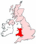
Map of Llandudno Wales and Surrounding Areas
Detailed street map of Llandudno town centre and the surrounding areas, towns & villages.
View Larger Map |
||
 |
||
Llandudno Map Wales Showing the Town and its Surroundings
Street Map of the Welsh Town of Llandudno: Find places of interest in the town of Llandudno in Clwyd, Wales UK, with this handy printable street map. View streets in the centre of Llandudno and areas which surround Llandudno, including neighbouring villages and attractions. Large Llandudno map.
Places of interest in and surrounding Llandudno, Clwyd include: The Moorfield Hotel, Llandudno Library, The Kings Arms, Llandudno Train Station (Railway Station), Llandudno Post Office, The A470, The Nevill Pub, Llandudno Station, St Bueno's Church, Holy Trinity Church, Llandudno Football Club, Llanrhos, Abbey Nursing Home, The A546, The Mostyn Guest House, Gogarth, Llandudno Miniature Golf Course, The Jasmine House Restaurant, Bryniau Wood, St Sior Primary School, Llandudno Hostel, Llandudno Museum, Great Orme Country Park, Llandudno Hospital, Lawn Cemetery, The John Bright Sports Centre, Llandudno Cricket Club, Llandudno Magistrates Court and more.
Highlights of This Llandudno Clwyd Map:
- Easy to Print Map for Town Centre of Llandudno.
- Get a Satellite View of Llandudno.
- Find Routes To and From Llandudno area.
- View Villages and Towns Around Llandudno.
- Identify Llandudno Areas of Interest.
- See Llandudno Housing & Industrial Estates.
- Easily Find Llandudno Tourist Attractions.
- Zoom in, Pan and Move Around Llandudno.
- See Rivers, Canals, Lakes and Waterways.
The Post Code for Llandudno is: LL30
Locate streets and roads in and near Llandudno, locate interesting places and attractions in and near Llandudno, locate churches and religious centres in and near Llandudno, locate hospitals and health centres in and near Llandudno, locate towns and villages surrounding Llandudno area.
More Maps of Wales:
- Map of Tredegar Area & Surroundings Wales
- Map of Blackwood Area & Surroundings Wales
- Map of Aberystwyth Area & Surroundings Wales
- Map of Connah's Quay Area & Surroundings Wales
- Map of Porthcawl Area & Surroundings Wales
Maps English Towns|Maps Spanish Towns | Eire Town Maps | France Town Maps | Hants