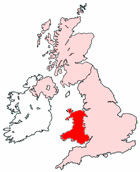
Map of Bridgend Wales and Surrounding Areas
Detailed street map of Bridgend town centre and the surrounding areas, towns & villages.
View Larger Map |
||
 |
||
Bridgend Map Wales Showing the Town and its Surroundings
Street Map of the Welsh Town of Bridgend: Find places of interest in the town of Bridgend in Mid Glamorgan, Wales UK, with this handy printable street map. View streets in the centre of Bridgend and areas which surround Bridgend, including neighbouring villages and attractions. Large Bridgend map.
Places of interest in and surrounding Bridgend, Mid Glamorgan include: The Ogmore River, Evergreen Hall, The Riverside Tavern, Bridgend Library, Tremains Wood, The Princess of Wales Hospital, Oldcastle Primary School, Bridgend Police Station, Penybont Primary School, Wildmill Railway Station, Heronsbridge School, Tremains Guest House, Brackla, Bridgend Train Station, Bridgend Station, The Wyndham Arms Pub, The Railway Pub, Brackla Industrial Estate, Ewenny River, Brewery Field, Wildmill, Bridgend College, Simonstone, Bridgend Industrial Estate, Chapel Wood, Waterton, Newbridge Fields, Hernstone, Newcastle, St Mary's RC Church, Mair's Guest House, Alexandra Guest House, Brackla Street Centre, Nant Celn Glas, Riversdale Surgery, Tingle Wood, Freeschool Court Evangelical Church, Vine Christian Centre, Pendre, River Wood, Bridgend RFC, The A473, Coity, Bridgend Gospel Hall, Bridgend Bus Station and more.
Highlights of This Bridgend Mid Glamorgan Map:
- Easy to Print Map for Town Centre of Bridgend.
- Get a Satellite View of Bridgend.
- Find Routes To and From Bridgend area.
- View Villages and Towns Around Bridgend.
- Identify Bridgend Areas of Interest.
- See Bridgend Housing & Industrial Estates.
- Easily Find Bridgend Tourist Attractions.
- Zoom in, Pan and Move Around Bridgend.
- See Rivers, Canals, Lakes and Waterways.
The Post Code for Bridgend is: CF31
Locate streets and roads in and near Bridgend, locate interesting places and attractions in and near Bridgend, locate churches and religious centres in and near Bridgend, locate hospitals and health centres in and near Bridgend, locate towns and villages surrounding Bridgend area.
More Maps of Wales:
- Map of Cwmbran Area & Surroundings Wales
- Map of Llanelli Area & Surroundings Wales
- Map of Neath Area & Surroundings Wales
- Map of Barry Area & Surroundings Wales
- Map of Wrexham Area & Surroundings Wales
Maps English Towns|Maps Spanish Towns | Eire Town Maps | France Town Maps | Hants