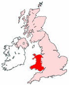
Map of Wrexham Wales and Surrounding Areas
Detailed street map of Wrexham town centre and the surrounding areas, towns & villages.
View Larger Map |
||
 |
||
Wrexham Map Wales Showing the Town and its Surroundings
Street Map of the Welsh Town of Wrexham: Find places of interest in the town of Wrexham in Clwyd, Wales UK, with this handy printable street map. View streets in the centre of Wrexham and areas which surround Wrexham, including neighbouring villages and attractions. Large Wrexham map.
Places of interest in and surrounding Wrexham, Clwyd include: St Giles Church, Wrexham Maelor Hospital, Wrexham Station, The Fairfield Tavern Pub, Wrexham Library, Chicago Rock Cafe, Glyndwr University, Rhosnesni, Wrexham Memorial Hall, Wrexham Money Centre, Wrexham General Railway Station, Theatre Grove Park, The Ramada Plaza Hotel, Big Wood, The Peoples Market, St Anne's Catholic Primary School, Marchwiel Reservoir, Coed-y-Glyn, Yale College, The A525, Wrexham High Street, Wrexham Council Offices, Lewis Wood, The River Clywedog, Wrexham Train Station (Wrexham Central Railway Station), Canolfan Tenis, All Saints Church, Chapel Cross, Acton Park, Wrexham Methodist Church, Rhos-ddhu, Hafod y Wern Community Primary School, Queensway Sports Complex, Wrexham Bus Station, Parciau Bellevue Park, Wrexham Cemetery, Yale Hospital, The Swan Inn, Hightown, St Giles School, Acton, The A5152, Felin Puleston, The Stow Bed and Breakfast, Woodhey Guest House, Bryn-y-cabanau Wood and more.
Highlights of This Wrexham Clwyd Map:
- Easy to Print Map for Town Centre of Wrexham.
- Get a Satellite View of Wrexham.
- Find Routes To and From Wrexham area.
- View Villages and Towns Around Wrexham.
- Identify Wrexham Areas of Interest.
- See Wrexham Housing & Industrial Estates.
- Easily Find Wrexham Tourist Attractions.
- Zoom in, Pan and Move Around Wrexham.
- See Rivers, Canals, Lakes and Waterways.
The Post Code for Wrexham is: LL1
Locate streets and roads in and near Wrexham, locate interesting places and attractions in and near Wrexham, locate churches and religious centres in and near Wrexham, locate hospitals and health centres in and near Wrexham, locate towns and villages surrounding Wrexham area.
More Maps of Wales:
- Map of Llanelli Area & Surroundings Wales
- Map of Barry Area & Surroundings Wales
- Map of Fishguard Area & Surroundings Wales
- Map of Conwy Area & Surroundings Wales
- Map of Neath Area & Surroundings Wales
Maps English Towns|Maps Spanish Towns | Eire Town Maps | France Town Maps | Hants