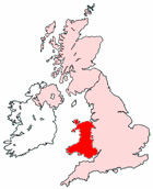
Map of Rhyl Wales and Surrounding Areas
Detailed street map of Rhyl town centre and the surrounding areas, towns & villages.
View Larger Map |
||
 |
||
Rhyl Map Wales Showing the Town and its Surroundings
Street Map of the Welsh Town of Rhyl: Find places of interest in the town of Rhyl in Clwyd, Wales UK, with this handy printable street map. View streets in the centre of Rhyl and areas which surround Rhyl, including neighbouring villages and attractions. Large Rhyl map.
Places of interest in and surrounding Rhyl, Clwyd include: Rhyl High Street, The Sussex Pub, The Westminster Hotel, The Berwyn Guest House, Rhyl Bus Station, The A548, Kinmel Bay, The Swan Inn, Palace Fun Centre, The River Clwyd, The Cut, Rhyl Police Station, Rhyl High School, Rhyl Seaquarium, Rhyl Library Museum & Arts Centre, Queens Market, Rhyl Train Station (Railway Station), The A525, Rhuddian, Pwll Brickfields Pond, Marine Lake, Towyn, The Royal Alexandra Hospital, Rhyl Tourist Information Centre, Rhyl Station and more.
Highlights of This Rhyl Clwyd Map:
- Easy to Print Map for Town Centre of Rhyl.
- Get a Satellite View of Rhyl.
- Find Routes To and From Rhyl area.
- View Villages and Towns Around Rhyl.
- Identify Rhyl Areas of Interest.
- See Rhyl Housing & Industrial Estates.
- Easily Find Rhyl Tourist Attractions.
- Zoom in, Pan and Move Around Rhyl.
- See Rivers, Canals, Lakes and Waterways.
The Post Code for Rhyl is: LL18
Locate streets and roads in and near Rhyl, locate interesting places and attractions in and near Rhyl, locate churches and religious centres in and near Rhyl, locate hospitals and health centres in and near Rhyl, locate towns and villages surrounding Rhyl area.
More Maps of Wales:
- Map of Colwyn Bay Area & Surroundings Wales
- Map of Pontypridd Area & Surroundings Wales
- Map of Pontypool Area & Surroundings Wales
- Map of Caerphilly Area & Surroundings Wales
- Map of Merthyr Tydfil Area & Surroundings Wales
Maps English Towns|Maps Spanish Towns | Eire Town Maps | France Town Maps | Hants