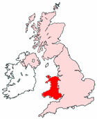
Map of Monmouth Wales and Surrounding Areas
Detailed street map of Monmouth town centre and the surrounding areas, towns & villages.
View Larger Map |
||
 |
||
Monmouth Map Wales Showing the Town and its Surroundings
Street Map of the Welsh Town of Monmouth: Find places of interest in the town of Monmouth in Gwent, Wales UK, with this handy printable street map. View streets in the centre of Monmouth and areas which surround Monmouth, including neighbouring villages and attractions. Large Monmouth map.
Places of interest in and surrounding Monmouth, Gwent include: The Gate House Pub, Singleton Court Business Park, Wyesham, The A466, The River Wye, Penallt, Monmouth Catholic Church, Kymin, Dixton, The Savoy Theatre, Priory Grove, Lady Grove, St Dial's Wood, Holywell Wood, Monmouth Leisure Centre Pool, Great Castle House, Osbaston, Parade House, Harper's Wood, Monmouth Police Station, Chippenham Surgery, Monmouth Cemetery, St Mary's Priory Church, The A40, The River Monnow, Garth Wood, Over Monnow, Parish Church of St Thomas the Martyr Monmouth, The Castle & Regimental Museum, Monmouth Canoe Hire & Activity Centre, Monmouth Comprehensive School, Mayhill, Monmouth Priory, The Nelson Museum & Local History Centre, Monmouth Leisure Centre Football Field, Monmouth Caravan Park, Lord's Wood, The Robin Hood Inn Pub, Monmouth School and more.
Highlights of This Monmouth Gwent Map:
- Easy to Print Map for Town Centre of Monmouth.
- Get a Satellite View of Monmouth.
- Find Routes To and From Monmouth area.
- View Villages and Towns Around Monmouth.
- Identify Monmouth Areas of Interest.
- See Monmouth Housing & Industrial Estates.
- Easily Find Monmouth Tourist Attractions.
- Zoom in, Pan and Move Around Monmouth.
- See Rivers, Canals, Lakes and Waterways.
The Post Code for Monmouth is: NP25
Locate streets and roads in and near Monmouth, locate interesting places and attractions in and near Monmouth, locate churches and religious centres in and near Monmouth, locate hospitals and health centres in and near Monmouth, locate towns and villages surrounding Monmouth area.
More Maps of Wales:
- Map of Denbigh Area & Surroundings Wales
- Map of Pencoed Area & Surroundings Wales
- Map of Newbridge Area & Surroundings Wales
- Map of Caerleon Area & Surroundings Wales
- Map of Pembroke Dock Area & Surroundings Wales
Maps English Towns|Maps Spanish Towns | Eire Town Maps | France Town Maps | Hants