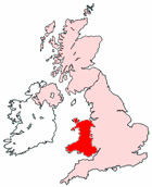
Map of Llandrindod Wells Wales and Surrounding Areas
Detailed street map of Llandrindod Wells town centre and the surrounding areas, towns & villages.
View Larger Map |
||
 |
||
Llandrindod Wells Map Wales Showing the Town and its Surroundings
Street Map of the Welsh Town of Llandrindod Wells: Find places of interest in the town of Llandrindod Wells in Powys, Wales UK, with this handy printable street map. View streets in the centre of Llandrindod Wells and areas which surround Llandrindod Wells, including neighbouring villages and attractions. Large Llandrindod Wells map.
Places of interest in and surrounding Llandrindod Wells, Powys include: Lletty Cottage Covert, Llandrindod Wells Hospital and County War Memorial, The River Ithon, Rock Park International Bowling Greens, Nant-y-groes, Dolberthog Wood, Llandrindod Wells Jobcentre Plus, Llandrindod Wells Police Station, Llandrindod Wells Train Station (Railway Station), The National Cycle Collection Museum, Portland House Bed and Breakfast, Llandrindod Wells Spa Town Trust, Powys College Llandrindod Wells, New Life Church, Llandrindod Wells High Street, Arlais Brook, Rock Park Health Centre, Llandrindod Wells Tourist Information Centre, The Rock Park Spa Centre, Llandrindod Wells Library, Llanyre, Llandrindod Wells Pavilion, The Hampton Hotel, Ridgebourne and more.
Highlights of This Llandrindod Wells Powys Map:
- Easy to Print Map for Town Centre of Llandrindod Wells.
- Get a Satellite View of Llandrindod Wells.
- Find Routes To and From Llandrindod Wells area.
- View Villages and Towns Around Llandrindod Wells.
- Identify Llandrindod Wells Areas of Interest.
- See Llandrindod Wells Housing & Industrial Estates.
- Easily Find Llandrindod Wells Tourist Attractions.
- Zoom in, Pan and Move Around Llandrindod Wells.
- See Rivers, Canals, Lakes and Waterways.
The Post Code for Llandrindod Wells is: LD1
Locate streets and roads in and near Llandrindod Wells, locate interesting places and attractions in and near Llandrindod Wells, locate churches and religious centres in and near Llandrindod Wells, locate hospitals and health centres in and near Llandrindod Wells, locate towns and villages surrounding Llandrindod Wells area.
More Maps of Wales:
- Map of Bethesda Area & Surroundings Wales
- Map of Ruthin Area & Surroundings Wales
- Map of Senghenydd Area & Surroundings Wales
- Map of Rhymney Area & Surroundings Wales
- Map of Blaenavon Area & Surroundings Wales
Maps English Towns|Maps Spanish Towns | Eire Town Maps | France Town Maps | Hants