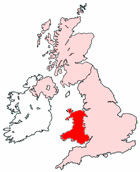
Map of Gorseinon Wales and Surrounding Areas
Detailed street map of Gorseinon town centre and the surrounding areas, towns & villages.
View Larger Map |
||
 |
||
Gorseinon Map Wales Showing the Town and its Surroundings
Street Map of the Welsh Town of Gorseinon: Find places of interest in the town of Gorseinon in West Glamorgan, Wales UK, with this handy printable street map. View streets in the centre of Gorseinon and areas which surround Gorseinon, including neighbouring villages and attractions. Large Gorseinon map.
Places of interest in and surrounding Gorseinon, West Glamorgan include: Gorseinon College, Gorseinon Police Station, Gorseinon Infants School, The Toby Carvery, The Riverside Inn Pub, Gorseinon High Street, The Salvation Army Gorseinon, Gorseinon Shopping Park, The Blessed Sacrament Church, Bryn Hall Evangelical Church, Glanymor Park, Penyrheol Theatre, Penyrheol, Gowerton Railway Station, Gorseinon Cricket & Rugby Club, Bwlchymynydd, The A4240, West Street Christian Centre, Gowerton, Kingsbridge Cemetery, Rugby Football Ground, Gorseinon Junior School, The M4 Motorway, Parc y Werin, Garden Village, Loughor and more.
Highlights of This Gorseinon West Glamorgan Map:
- Easy to Print Map for Town Centre of Gorseinon.
- Get a Satellite View of Gorseinon.
- Find Routes To and From Gorseinon area.
- View Villages and Towns Around Gorseinon.
- Identify Gorseinon Areas of Interest.
- See Gorseinon Housing & Industrial Estates.
- Easily Find Gorseinon Tourist Attractions.
- Zoom in, Pan and Move Around Gorseinon.
- See Rivers, Canals, Lakes and Waterways.
The Post Code for Gorseinon is: SA4
Locate streets and roads in and near Gorseinon, locate interesting places and attractions in and near Gorseinon, locate churches and religious centres in and near Gorseinon, locate hospitals and health centres in and near Gorseinon, locate towns and villages surrounding Gorseinon area.
More Maps of Wales:
- Map of Pontardawe Area & Surroundings Wales
- Map of Mountain Ash Area & Surroundings Wales
- Map of Shotton Area & Surroundings Wales
- Map of Penarth Area & Surroundings Wales
- Map of Risca Area & Surroundings Wales
Maps English Towns|Maps Spanish Towns | Eire Town Maps | France Town Maps | Hants